
The world’s oceans are rapidly rising as waters warm and ice sheets melt.
Coastal cities like New York — much of which lies on an island barely above sea level — are at serious risk of flooding.
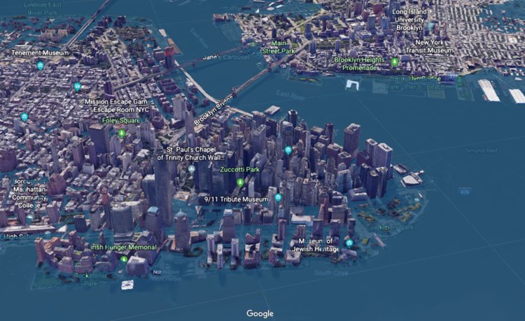
Research group Climate Central has created a plug-in for Google Earth that illustrates how catastrophic an “extreme” sea-level rise scenario projected for the year 2100 would be, based on data in a 2017 report from the National Oceanic and Atmospheric Agency (NOAA).
The group’s estimates are based on the worst-case scenario forecasting from NOAA’s data, and it puts into perspective how dangerous the situation could get for the lowest-lying New York City neighborhoods.
The Financial District — the birthplace of New York City and home to a number of landmarks, institutions, Wall Street banks, and tech companies — will be particularly hard-hit.
We’ve compiled Climate Central’s data into a series of maps to see which of the world’s largest financial institutions could be inundated if climate change continues unabated.
Goldman Sachs, one of the most powerful of all the banks, could be completely flooded. The same goes for Citigroup and Merrill Lynch. Banks that have decamped to Midtown offices in recent years will be relatively unscathed.
Check out the maps below: